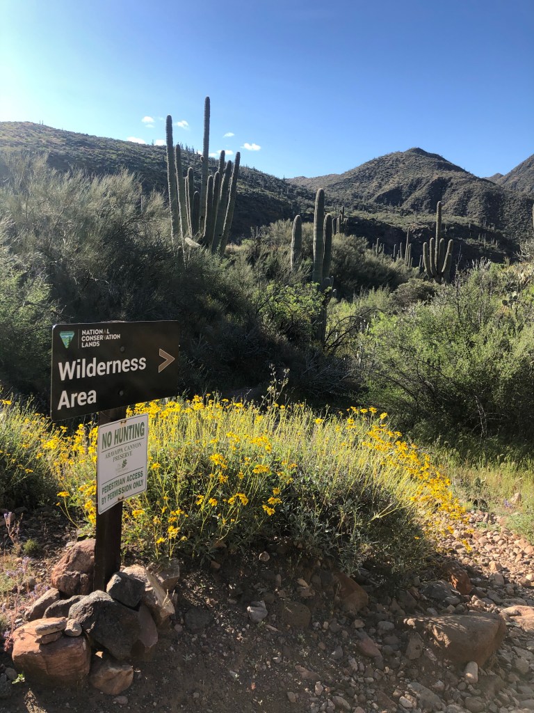
Like many of us, I’ve got some extra time on my hands lately, and figured I would use some of it for hiking. Mainly I’ve been hiking near my house on the less popular sections of trail that I know of, every once in a while though it’s nice to see some new scenery. Ararvaipa Canyon is a place I had heard of and seen some cool pics from, it was on a list of stuff to do, but not really a high priority. In looking for a different, long day hike to do, it came up. You need to have a permit to enter the wilderness area and they only allow 50 people per day to be there, good opportunity for social distancing!
I went to good ole’ recreation.gov and organized the permit, only $11.00 out the door! I got the last slot for April 9th, about a week and a half ahead of time. I’d recommend trying a to reserve a few weeks in advance, especially if you want to camp with a couple people, permits become available 13 weeks ahead of the entry date.
The night before I got all my stuff together, I took some extra things because it’s pretty isolated and I’d be by myself. I even threw in my stove and a Mountain House meal, if I was to get stranded a hot meal would be fantastic!
The next morning I got up pretty easily when my alarm went off at 4:45, made some coffee and was out the door. The drive there was about 2 1/2 hours. the last 45 minutes or so is past a lot of surface mines, sad to see the damage it does. The last time I was in this area was on a 100 mile bike ride, the hills here a big, and it sure was nice to be in the truck this time! After driving the 12 miles or so of dirt road, I hit the small trailhead. I loaded up, signed the trail register and off I went a little before 8 am.
The first part of the trial winds down through cactus and tall brush to get to the stream bed. I didn’t really know what to expect out of this hike, I knew I’d be walking in the water, but not how much, at about .3 miles in it was time to cross the stream for the first time, so I just waded on in and started the day of wet feet!
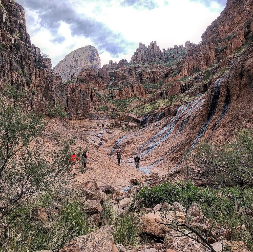
Early on I was trying to walk on the bank as much as possible, but there was a lot of bushwhacking and scrambling on rocks. At one point a was going up a loose rock section, noticed I was about 20 feet above the stream and a fall would entail some bouncing on rocks before landing in the water. Since I was alone, just walking in the stream seemed the safest, and this was my technique the rest of the day. A good positive of this, the best views down the canyon, and safety…
The views are pretty incredible once you get into the canyon, and I passed a number of great looking campsites. I definitely want to come back here for a night or two and be able to hike the entire canyon and explore a side canyon or two. I was moving pretty quickly to see as much of the main canyon as possible, the water was a really nice temperature and except for some deep pools that are easy to see in the crystal clear water, never more than knee deep.
Just shy of 7 miles I turned around, I didn’t want to feel like I was slogging my way back to the trail head, and by the time I got there I was glad to take the boots off! This is an incredible, unique backcountry place and I’m glad it has been preserved as a wilderness area!
Want you need to know to hike or backpack Aravaipa Canyon
It is a wilderness area and other rules! Check them out on the BLM Website.
Your feet will be wet all day, accept this fact and move on. I wore my regular hiking boots and it wasn’t too bad, just had to empty the pebbles out twice! I don’t think TEVAS or Chacos would be the way to go because rocks would get in all day long. Do you have a great shoe or boot for hiking in water for long periods of time? Let me know!
These are definitely strange times for all of us. Who knew that just a few months into 2020 there’d be toilet paper hording and quarantines! Like many restaurants, the one that I work at is closed, which gives me quite bit of time right now. There is some work stuff to, but right now it’s not a whole lot.
I tend to get cabin fever pretty quickly when trapped in the house, even two days of no activity and I’m starting to aimlessly wander around the house. The one good thing is I enjoy solo outdoor activities. I think road biking is a pretty good for keeping a social distance, as long as you ride by yourself and give others a wide berth when passing.
The new standard morning viewA little mountain biking from the house
This weekend I signed up for the Ironman VR race. Basically you have 3 days to complete a 5k run, 90k bike, and 21k run. I’ve got the time and it’s something to do. It’s been quite awhile since I’ve ridden that far, we’ll see how it goes! Did the 5k portion this morning.
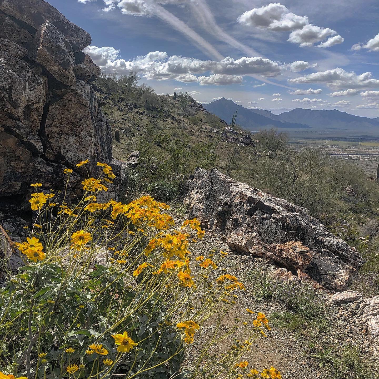
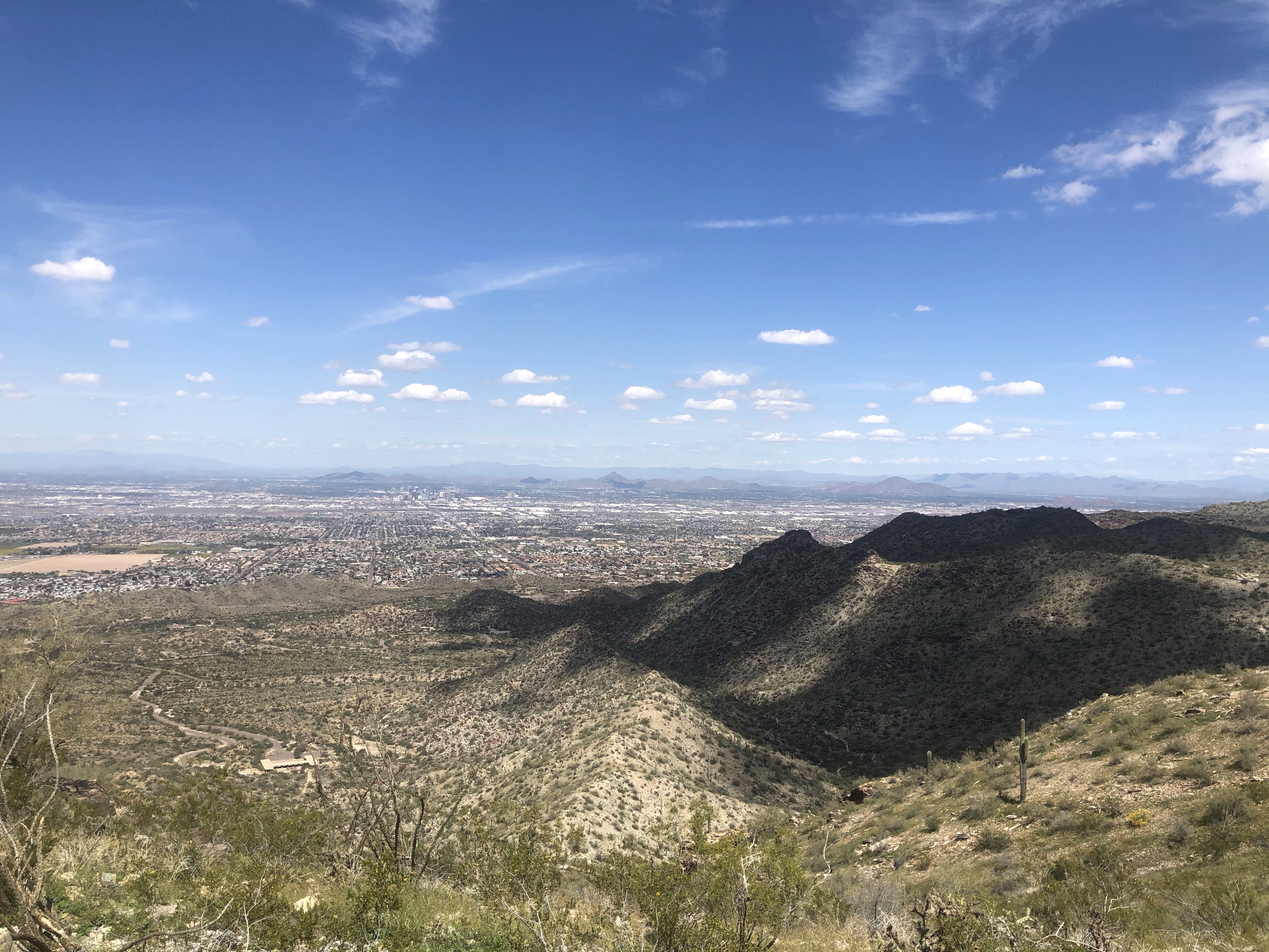
I’ve also gotten in some decent hiking, with some more planned this week. We live towards one end of South Mountain Park in Phoenix, and while parts of it can get overly crowded now, I know many places to go were you barley see anyone and it’s easy to feel safe.
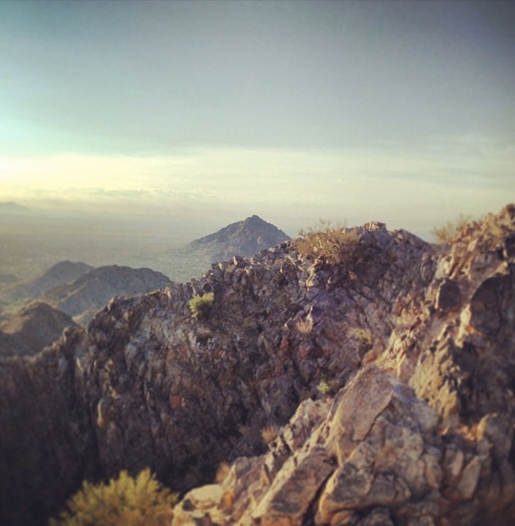
I want to do the complete the ridge line traverse from my Pyramid – National – Gila Loop hike on March 20th, by going over the last peak and not the pass, and I’ve got a permit for Aravaipa Canyon at the end of next week. I’ve never been there but, it’s supposed to be amazing! Just going to drive over in the morning, hike into the canyon for a few hours, then hike out. Definitely looking forward to checking out a new place!
Went for a hike toady, I had the time to to a loop I have wanted to try for a while but just hadn’t done. It was great to be on the trails exploring some new stuff. Love the fact that this amazing area is in my backyard.
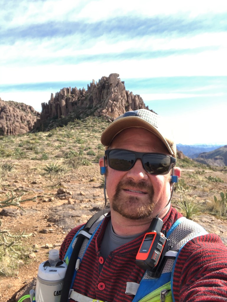
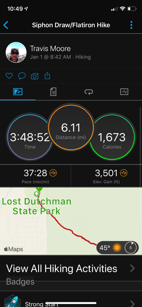
I wanted to start 2020 out with an adventure. I was kicking around a number of things, but I also wanted to be able to spend a good part of the day hanging out with my wife, Staying around Phoenix was obviously the way to go. I had tried to hike Siphon Draw-Flatiron a few years ago, I got off trail above the draw and ended up on the ridge below the Flatiron, saw a snake 3 feet away and called it a day. New Year’s Day seemed like a great day to tick this one off the list!
I made a quick stop for coffee and then headed out for Lost Dutchman State Park about 7:30. I got there early enough that there were lots of parking spots (not the case when I was leaving).
Besides the general fun of hiking, I wanted to test out my new Garmin InReach Satellite Communicator. So far I really like it, but I still need to learn exactly how it works. Pretty sure I’d be happier learning everything close to home with some cell service, than in the middle of nowhere when you need to use it!
Threw on the hydration pack, started some tunes and away I went.
The trail climbs slowly for the first mile or so as you leave the state park and enter the Superstition Wilderness area. The first section is well developed trail that get s a lot of traffic. This is a pretty cool state park, the Superstitions are awesome and this park has great access, views and what looks like pretty cool campsites.
It gets really cool at about the 1.5 mile mark as you get to Siphon Draw. It’s like a huge rock half-pipe for a bit the leads to the big rock filled gully you’ll be scrambling up through for a while.
Siphon Draw
There are a few times you’re faced with a small scramble up an 8-10 ft section, but there are lots of footholds and solid rock to grab. If you take your time and check things out you can find a pretty easy way up, I saw a few people negotiating the toughest sections with full packs.
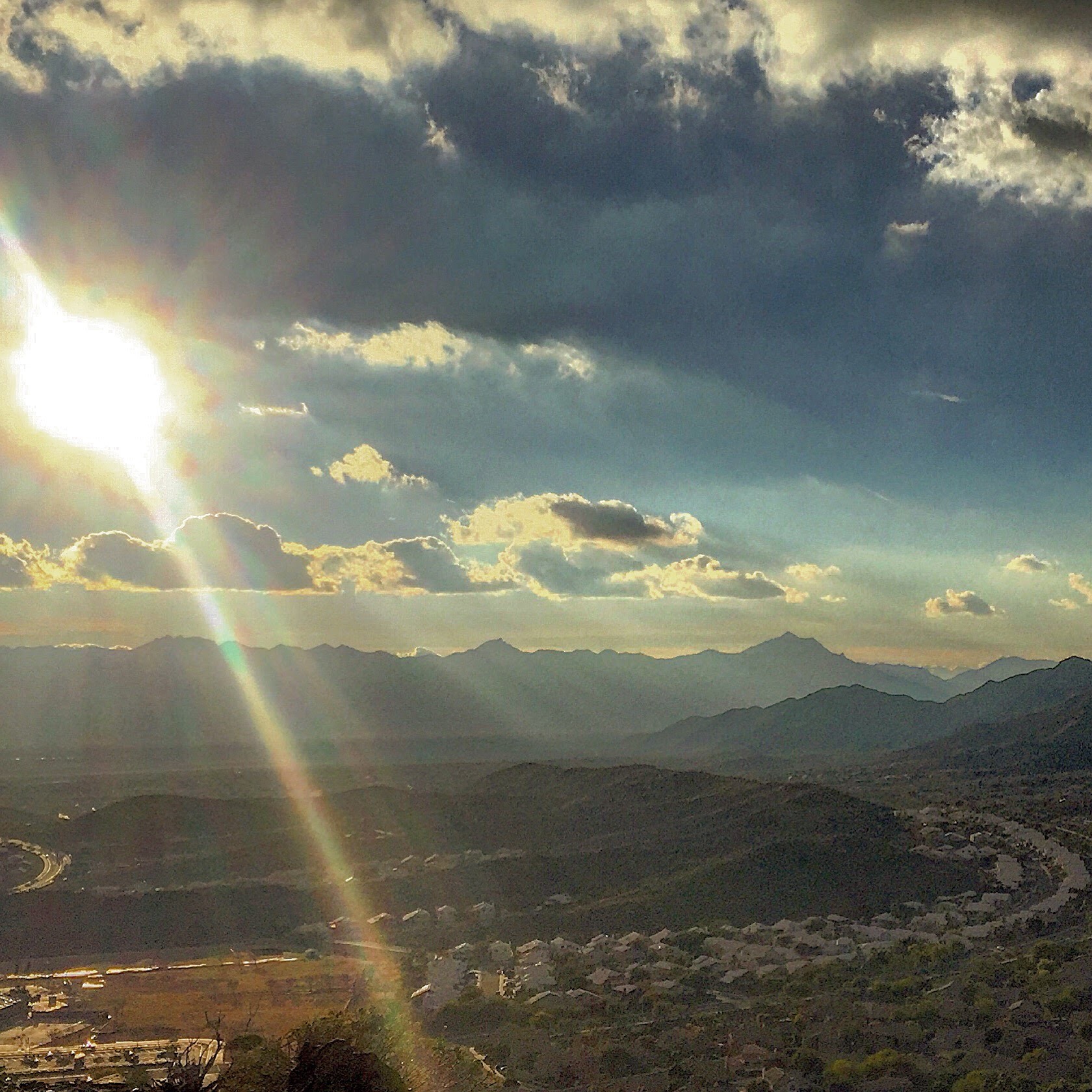
Once your’re past the toughest rock section the work is done and it’s just a quick stroll to the top of the Flatiron. It’s a really cool view of the whole valley, sweeping views of urban sprawl and also the Superstition Wilderness and Four Peaks. While it is a relatively challenging hike, it’s a very popular trail, when i was at the top of the Flatiron there were easily 15 other people up there as well.
I wanted to make it just a morning hike so I headed back down, but the are a few cool summits you could bag once you’ve gained that high ridge.
Looking down from Flatiron
This is not a hike where you end up blitzing your way down. There’s a lot of scrambling down rocks and loose dirt sections. There was a decent amount of moisture, and I have a overriding desire to do the Rock and Roll 1/2 Mary coming up so I was careful coming down, there were lots of chance to slip but it’s overall not bad
Coming down through Siphon Draw is just a s cool as going up, if you don’t feel like scrambling all the way to the top of the Flatiron, just hike to the draw, you won’t be disappointed.
Cruised on back the last little bit to the truck and headed home. if you head out here on a weekend or holiday, get there early! When I left at a little before 1pm the parking lots were packed and there was a 10 car line to get into the park.
I forgot to stop the Garmin Forerunner until I was driving on the highway. Props to both the Garmin and Strava folks for the trim activity function. I feel like we’ve all driven off with the tracker still on, or maybe it’s just me…
Overall it was a great hike and fun way t,o start the new year. From an InReach testing view point, I started the tracking, sent a preset message I was starting – but not the correct one for continued tracking. I also didn’t correctly send a rely message to a text from my dad. Fortunately I think I figured out both issues,
I want to be an expert with this thing before I really take it into the backcountry.
Sounds like I’ll need to go on some more hikes, terrible…
After an awesome time on last year’s trip I wanted to experience it again with the knowledge gained during that trip. I put in for a permit for the second weekend in September, hoping it might be a little cooler, but not really caring. It ended up being just as hot. Fortunately it was decently cloudy again for our hike down.
I work in the restaurant business in Phoenix, so I need to take my vacations in the summer, hence the warm weather Grand Canyon trips.
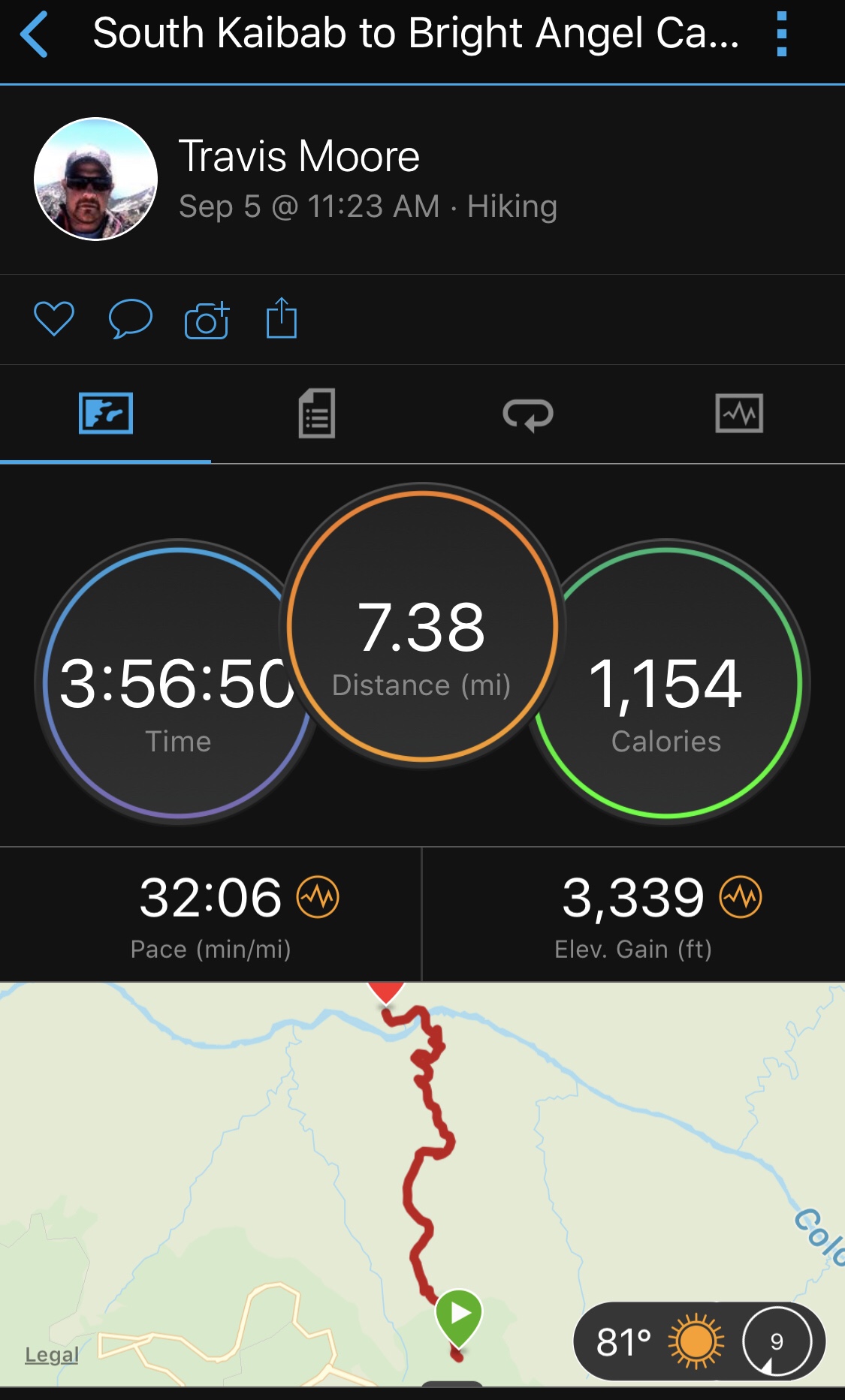
Just like last year we would hike down South Kaibab Trail on a Thursday, stay 2 nights at Bright Angel Campground, hike to Indian Garden via the Bright Angel Trail, camp there and then trek out Sunday morning. Unlike last year we got a nice early start Thursday morning, leaving Phoenix by 6am. We picked up our 3rd in Flagstaff and got to Grand Canyon by 10:30 am.
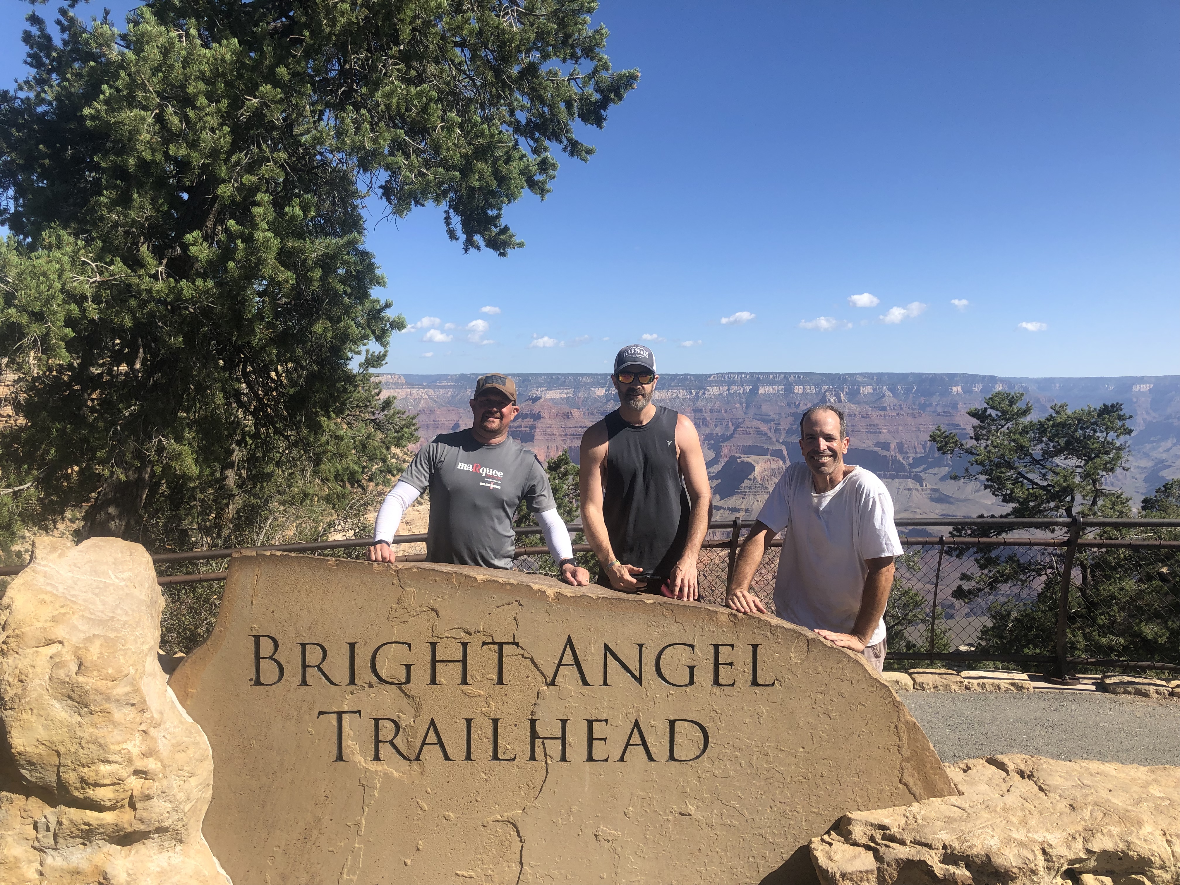
It was great knowing exactly where to park, which buses to hop on, and what to expect. We had no problem getting to the trailhead, the 2 bus drivers were super friendly and pretty humorous! Once we made it out to the South Kaibab trailhead we took a few pics, shouldered the packs and headed out for our adventure!
View from the South Kaibab TrailheadLooking up the trail from Ohh Ahh Point
Like always the first few miles of the trail are pretty crowded with day hikers and people just going to the first view points. Once you get past Cedar Ridge you see very few people on the trail and can really appreciate the serenity!
South Kaibab is an impressive trail, following a ridge line directly down into the canyon. Because of this the views are amazing, but it can most definitely get hot, and there is no water and very limited shade.
View from the Tip-off
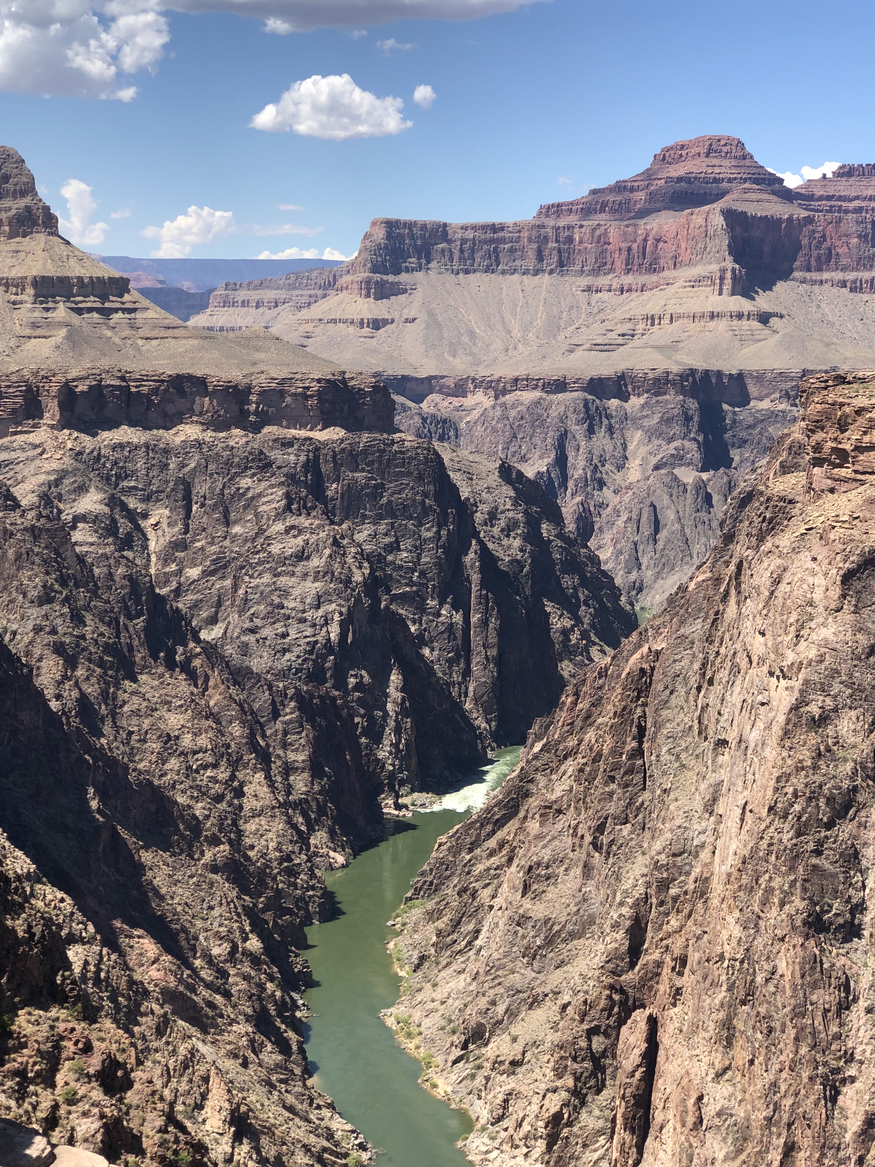
When you work your way all the way down the switchbacks, you come to a dark tunnel blasted into the cliff. It’s super cool, as you walk out of the tunnel, you walk right onto the black bridge and over the Colorado River!
Walking through the tunnel on to the black bridge – South Kaibab TrailOur campsite at Bright Angel
We got to Bright Angel Campground about 3pm, and scored a great campsite! As backcountry campsites go, BA is pretty ritzy! There are picnic tables at every site, flush toilets, and (if the pipeline doesn’t break) water! Not to mention the Phantom Ranch canteen, about a 5-10 minute stroll away, where they have cold beer! While the beers are $7 or $8 a can, they sure do taste good, not something you normally get to enjoy while backpacking. We determined that the best deal out of everything they sell there was the 75 cent packages of Oreos!
One campground improvement was the new food storage boxes. In the past each site had 2 big, old metal ammo boxes for food storage. You were supposed to flip them upside down when you left camp, so you were always treated to that banging around at 4:30 in the morning as people get ready to head out. The new boxes close up tight and hold far more than the old ones.
Anti-squirrel boxes
Friday, after a relaxing morning in camp, we headed out for a hike down the North Kaibab trail. My friend’s knee was a little sore from the hike in, so we only went around 3 miles out. We were hoping to make it to Ribbon Falls, but that was not happening.
I really want to explore The North Kaibab trail. Next year I’ll want to switch things up a bit, so I think a Rim to Rim is in order!
The work that has gone into making and maintaining these trails is impressive. The National Parks Service really does a great job, there seem to be miles and miles of the stone retaining walls seen in the picture below. I can only imagine what it took to build all of them!
North Kaibab Trail
After getting back to camp we felt like hiking around a little more, so we explored the River Trail. We crossed the Black Bridge and up a few of South Kaibab’s switchbacks, until we got to the River Trail junction, after that it’s a super cool rolling trail along the cliffs right above the river, and it leads right to the Silver Bridge. It was only about a mile and a half but it is totally worth it!
Bright Angel from the River TrailThe Black Bridge from Boat Beach
After hiking, it was time to cool off in the Colorado River, and it was fantastic! The water was pretty cold and super refreshing. We hung out on the beach and in the river for a good portion of the afternoon, a few sips of the Old Forester bourbon, chilled in BA Creek while we hiked, made it all that much better!
While we were at the river we saw a few of the rafting trips come through in their motorized rafts. We got to see the loading up and safety briefing from the Wilderness River Adventures group, who seemed like they’d be fun to run the river with!
Sunset from Boat Beach
After cooking up some food and one last visit to enjoy a few beers at Phantom Ranch, we sacked out to be ready for the hike to Indian Garden the next morning. It was a little warm for sleeping, taking the rain fly off the tent was key, and the stars were amazing to look up at!
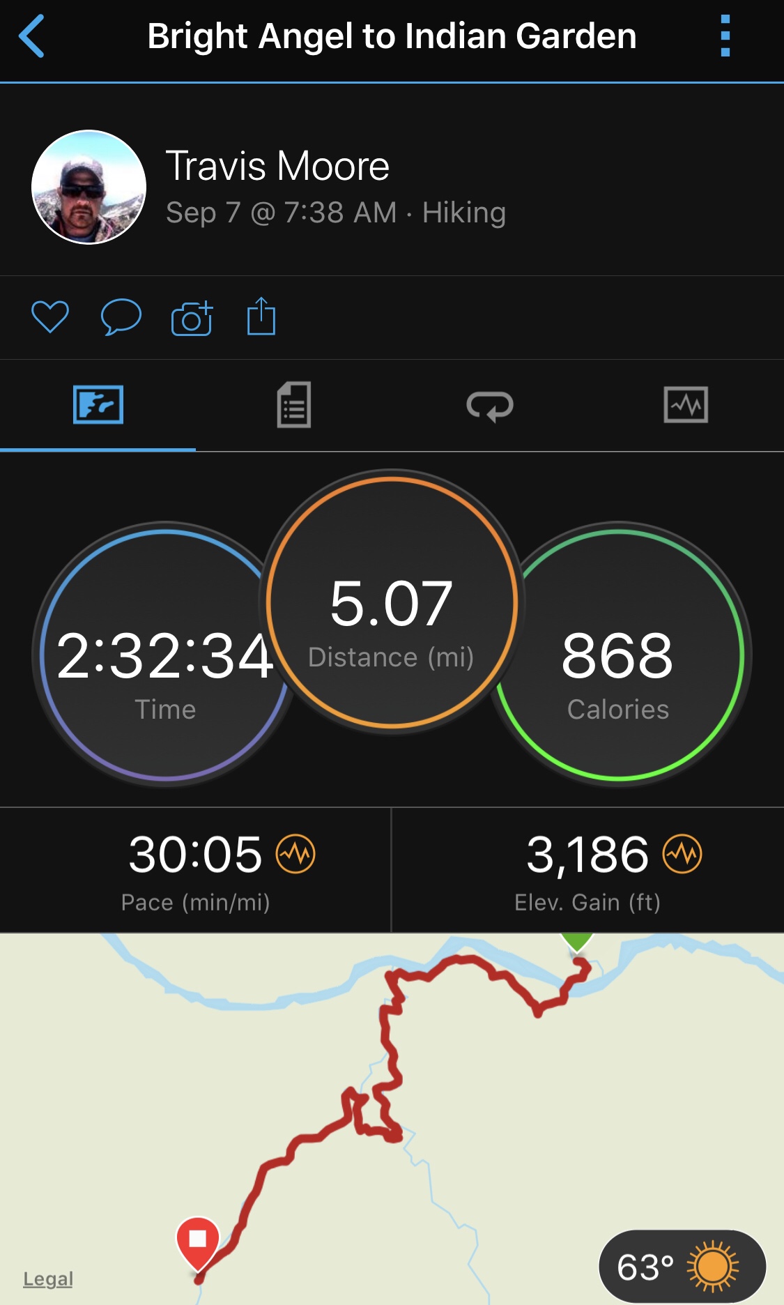
We got up around 6ish the next morning, cooked up a little breakfast and packed up. We were kind of aiming to start hiking around 7, and ended up heading out about 7:40.
The hike is so cool, cross the silver bridge and look right down the Colorado River, hike along the River Trail, and head up the canyon. Most of our hike was in the shade, and we were able to get through a decent part of the corkscrew while it was still pretty nice out.
Most Amazing Thing
Last year while hiking to Indian Garden we ran into an old neighbor of mine, who I hadn’t seen since they moved about 4 years ago. This year in about the same place who did we run into? You guessed it, the neighbor!
We cruised into Indian Garden and were able to grab what has become my favorite campsite there. The real bummer was seeing the the huge tree that shaded the main area was not standing anymore. Does anyone know what happened?
Looking down at part of the Bright Angel TrailBright Angel Trail
After setting up camp and hanging out for a bit, we headed out for the 1.5 mile hike to Plateau Point. If you’re at Indian Garden and feel like you’re up for it, this quick hike is a must. The view of the river, canyon and major buttes is awesome. It’s a flat hike, there’s a water spigot as the trail is right along the cross canyon pipeline, there’s even a California Condor who has a nest right below.
Plateau Point
After the Plateau Point hike there was some serious chilling out until dinner, a small stroll above the campground, a little conversation with our neighbor who was doing R2R, and watching the highway that is Bright Angel Trail. I’m pretty sure there are people moving up and down that trail at all hours of the day, it’s pretty cool to see all the different people that come by.
We hung out on a bench at the far end of the campground after it was quiet time, checking out the stars and such and then crashed out. It was definitely cooler at Indian Garden, but once again it was windy there!
Up a little before 6, brew some coffee, have some food and pack up. We did a little talking with our cool campsite neighbor and headed out for my favorite part of the hike.
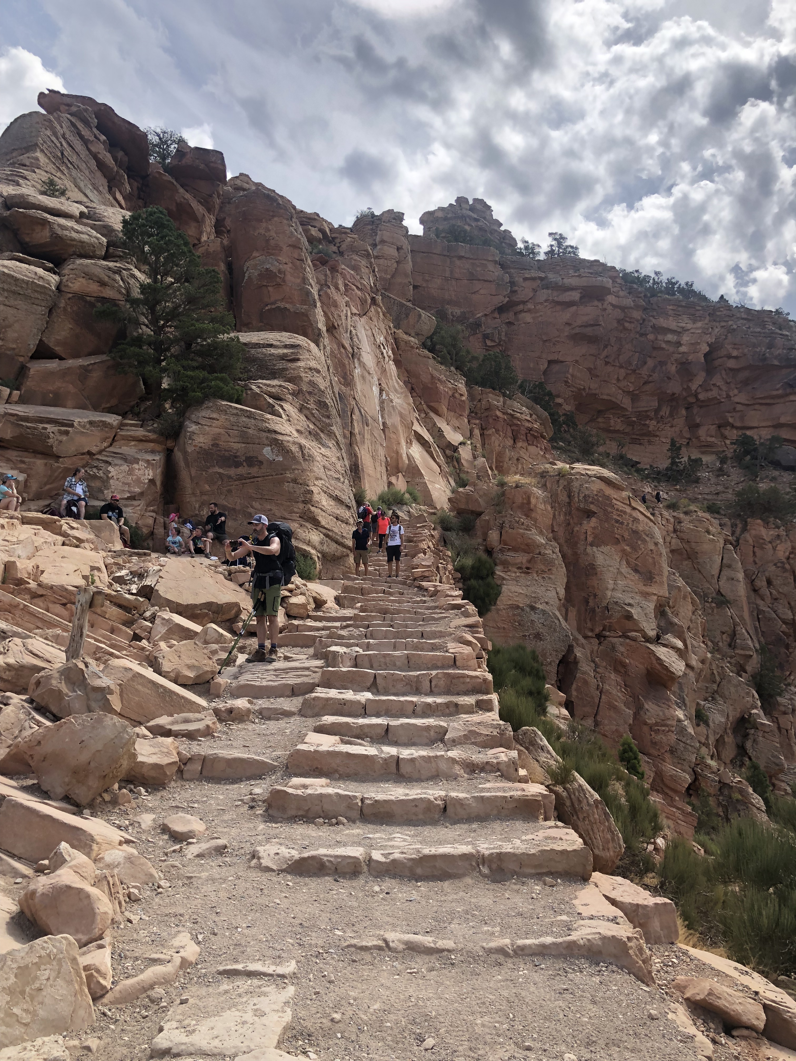
It’s 4.5 miles from Indian Garden to the South Rim. Looking up at the rim from Indian Garden you can’t believe a trail goes up that way! The trail heads up a small valley and then pretty soon you’re into the switchbacks, which pretty much go on for the rest of the hike.
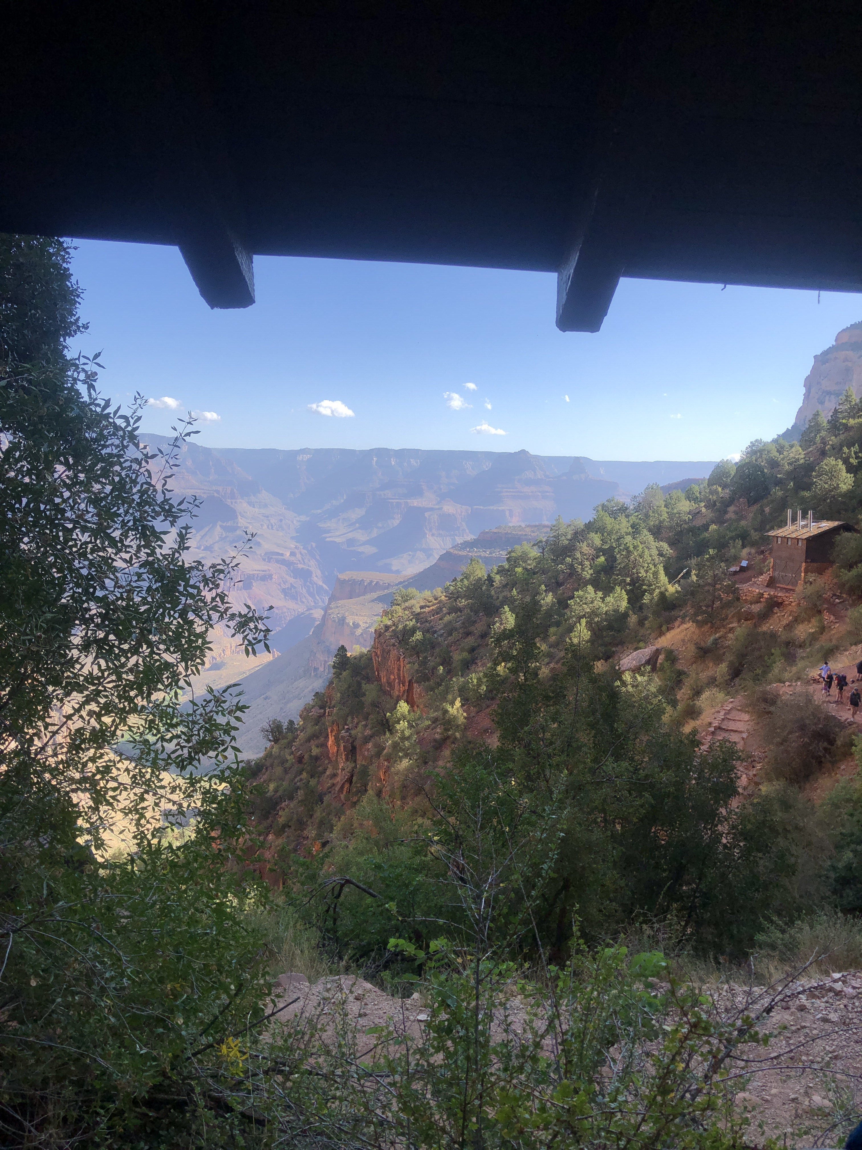
There are 2 rest houses along the trail, at 3 miles and 1 1/2 miles. They are nice little stops with a small rock house, water and bathrooms, they are also great milestones along the way besides the opportunity to relax.
View from 1 1/2 MIle Resthouse – Bright Angel Trail
As you get closer to the rim you start to see more and more people, by the time you into the last mile it can be a constant stream. It is a solid climb the whole way, but you can just put it in low gear and cruise your way up! We topped out about 9:45 am and hopped the bus back to the Backcountry Information Center parking lot.
Almost to the topRight after topping out
Grand Canyon is an amazing place, if you’ve never hiked it, you should at least once. Around every turn is another unbelievable vista, and the trails, bathrooms and campgrounds are top notch, especially for backcountry travel!