
Photo of the Week 9.12.22
Adventures in the Outdoors and Such


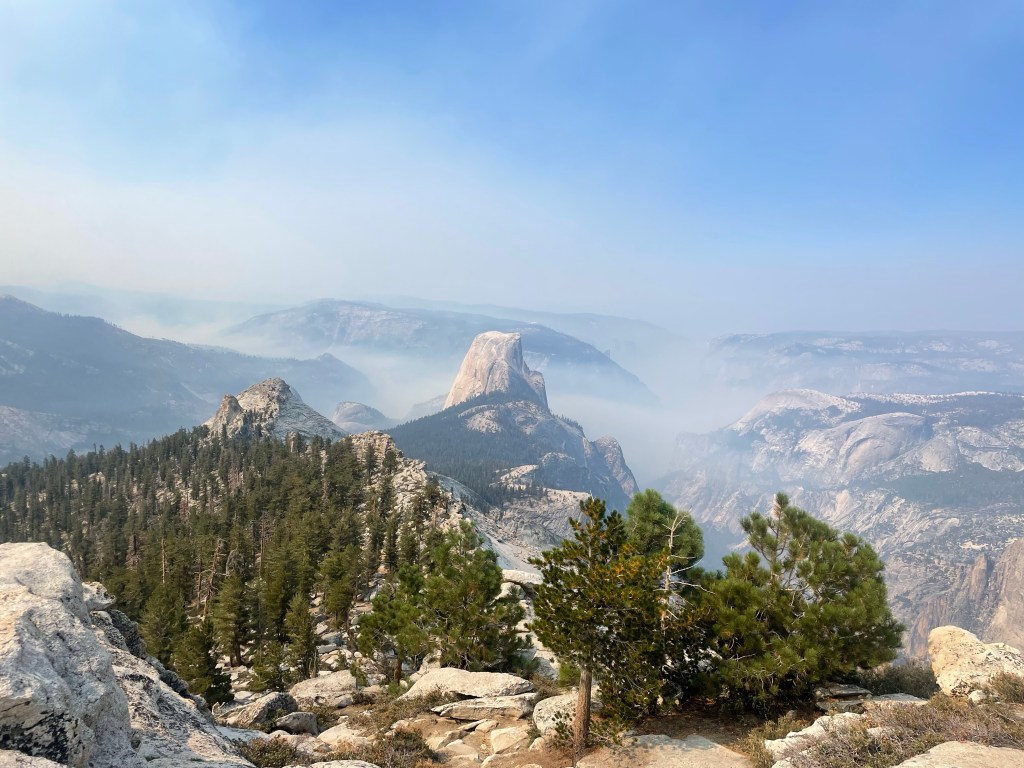
The Grand Canyon of the Tuolumne was unbelievable. This was a long discussed backpacking trip for 3 friends who hadn’t really seen each other for over 20 years. None of us had visited Yosemite and we were finally able to make it happen! We got to experience many amazing waterfalls, classic Yosemite views, and saw so few other people. We almost always had this impressive trail to ourselves, and I feel lucky to have had this initial Yosemite experience.
I picked up my friends in Las Vegas and we headed to Mammoth Lakes to stay for the night. We stayed with an old friend from Crested Butte, it was great to catch up and chill in this cool place.
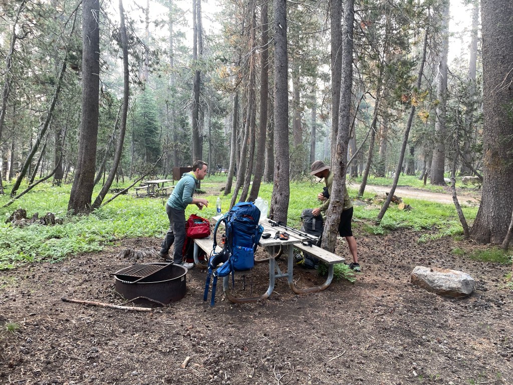
Sunday morning we got up early and headed into Yosemite National Park to start our adventure. We picked up our permit at the wilderness center and strolled to the YARTS bus pick up spot for the ride to the starting trailhead and camp for the night. The White Wolf Campground was nice, and wasn’t too crowded considering it’s summertime in Yosemite.
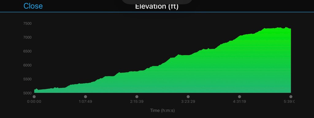
Day 1: The next morning we loaded up the packs and headed into the backcountry for a 4 day trip. The first day we descended almost 4000ft to the bottom of the canyon. While the miles of steep downhill were a bit rough on the knees, we were super stoked to have the packs on and start our hike.
The hike starts out in the forest as you leave the trailhead and climbs a bit to the edge of the canyon and then it’s time to descend!
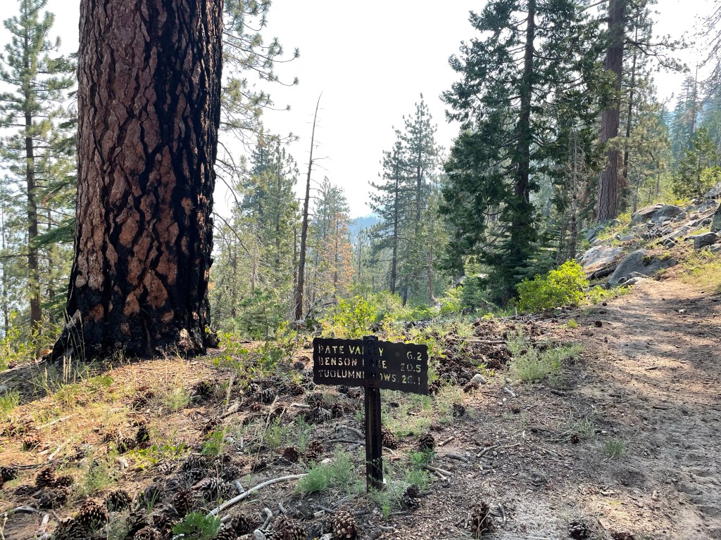
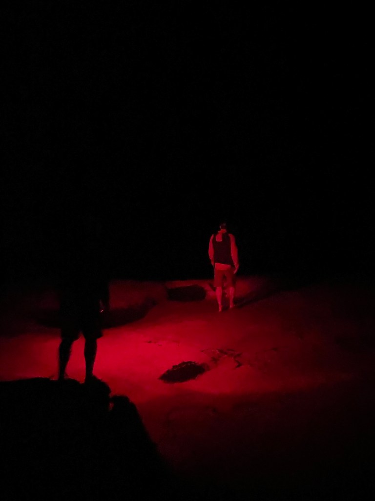
This was the only day we experienced any smoke issues from the wildfires, fortunately it didn’t seem to effect our breathing. After a final cruise along the river we made it to Pate Valley and found a nice campsite. We had easy river access and a quick swim in the river to cool us off and rinse off the dirt was most excellent.


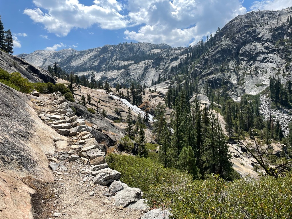
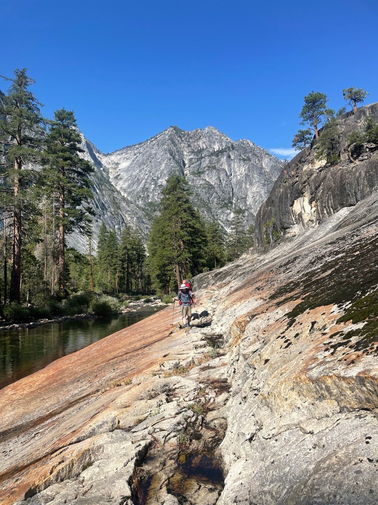
The Day 2 hike starts to follow the Tuolumne River, so we started to see small waterfalls and pools. After a bit we got to the good size climb up the Muir Gorge. We got really lucky with the weather, as we started this tough climb we got great cloud cover and little bit of rain to keep things cool. We saw 0 people all day on the trail.

That night’s campsite was almost certainly the best one I’ve ever had, with a waterfall and great swimming hole. After a quick set up in the rain and a little tent time while it down-poured, we dried out and went for a swim!
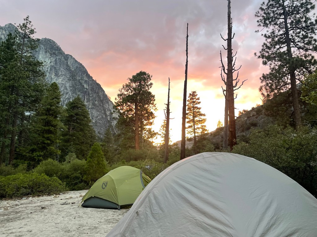
We got to relax on some big granite above camp to watch the sunset and then again to stare at the stars for a bit!

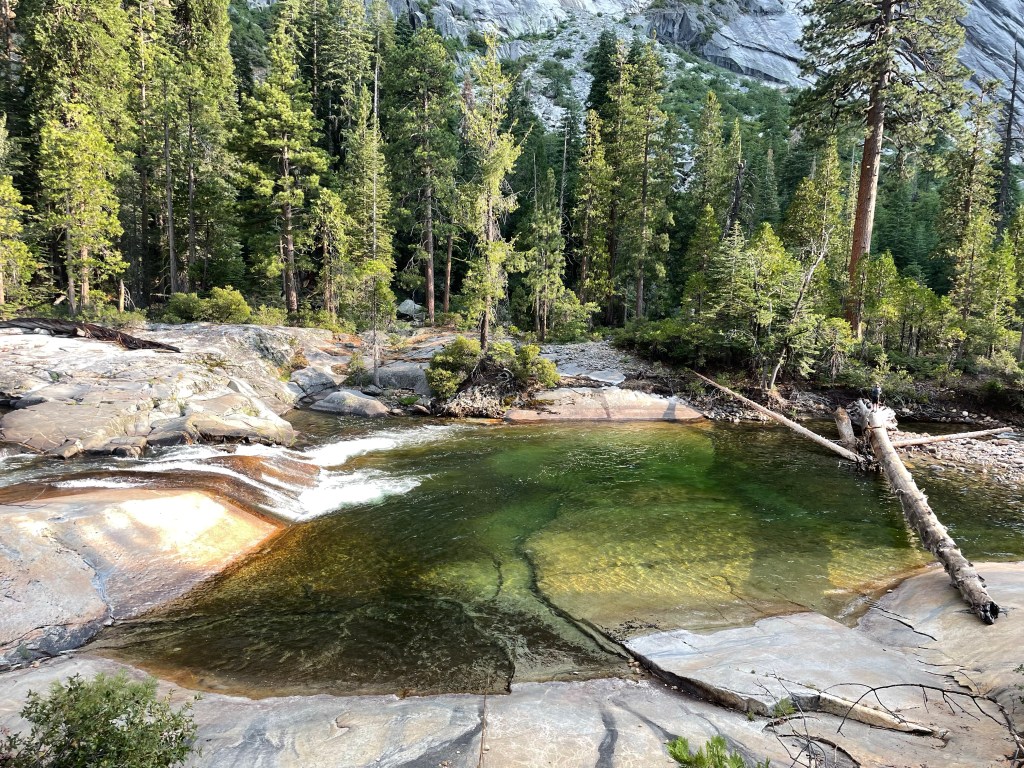
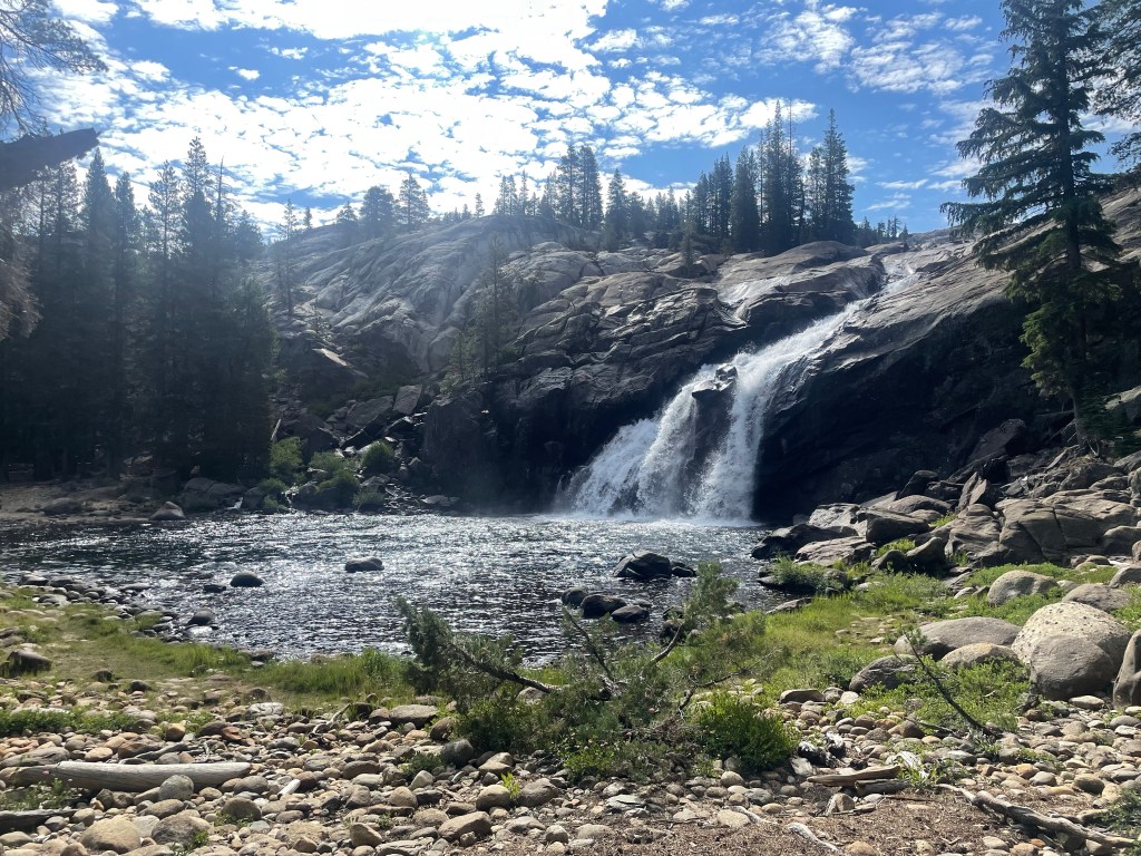
Day 3 was the day of so many waterfalls! There was more climbing than I thought, but it was totally worth it. Around almost every bend of the trail is a waterfall, pool or beautiful river view. We couldn’t help but stop to take so many pictures!
Waterwheel and Le Conte Falls were huge and it was so cool to be able to walk out into the rock right next to the rushing waters! We definitely spent a good amount of time with the packs off exploring these amazing features.


The afternoon of day three we finally started to see a few other people as we approached Glen Aulin, it was an almost weird experience after 2 1/2 days of seeing no one. We found a nice sheltered campsite and relaxed for our last night on the trail.

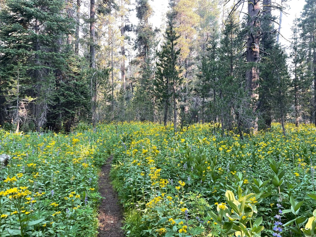
Day 4 was a great day of hiking. The climbs weren’t as tough, both White Cascade and Tuolumne Falls were awesome (and we had a great swim).

The last few miles are a great ending, as you walk into Tuolumne Meadows with it’s iconic granite domes and peaks. We stopped by the Parson’s Memorial Lodge, talked with a couple other backpackers and headed to the Tuolumne store for some ice cream!


After hiking out we headed to Independence for some me food, and hit up the Onion Valley campground for the night.
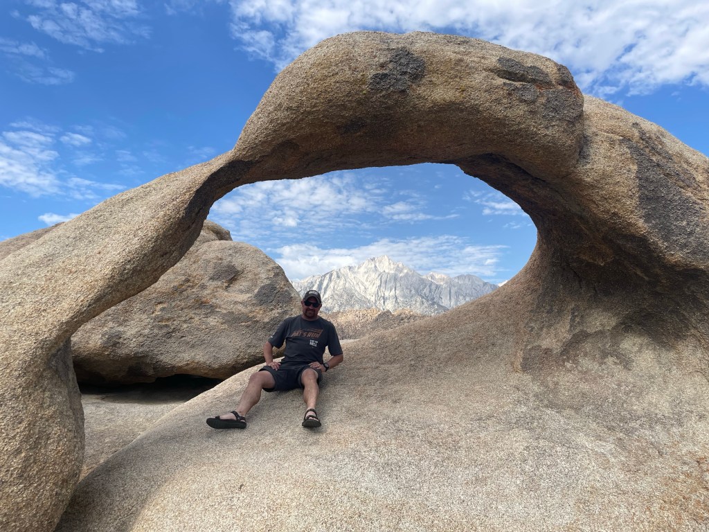
After a nice night in the tents at 9,200′ we headed towards Vegas so my friends could fly out the next day. After stops at the Möbius Arch, Star Wars Canyon, and Badwater Basin we cruised to our hotel. We relaxed for a bit in our rooms, went out for an excellent dinner, played a little gambling, and then crashed out!


Everything on the trip worked out so well, great friends, awesome scenery and hiking, and pretty much perfect weather. We only dealt with smoke from the wildfires on the first day, after that it was clear skies. I’ve never seen so many waterfalls, Yosemite is an amazing place and I feel so lucky to have such great long term friends.


Pretty sure it’s my 24thish year here in Phoenix, Az. I’ve always tried to be active year round, there’s a certain time of year that requires an early morning start, but it’s never actually cold and rarely rainy enough to delay something more than a day. But it does get hot, in August when you get up at 4:30am to be on the bike at first light and walk outside and it’s in the mid-90s you might curse. If you want to recreate outside all year, you have to be out there as it gets hot, acclimating to the temps as the summer progresses, and you still need to be careful!
For me the keys to successful summer training are:
It’s just starting to warm up here, getting into the low 100s everyday, I’ve been getting out regularly for at least a month, and have felt good so far. I’ve getting back to a pretty good set schedule with some afternoon gym time.
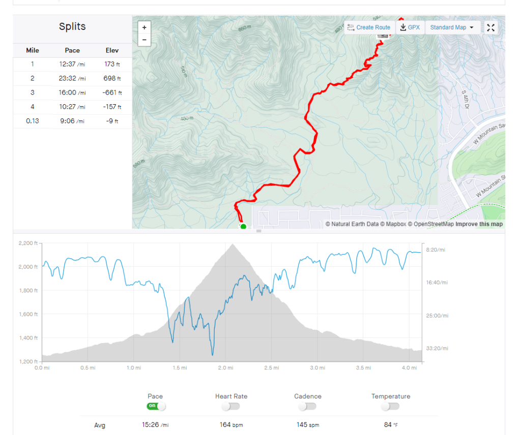
For hiking fitness I’m using the hike that has gotten me up and down the Grand Canyon 4 times and to the top of Mt. Whitney. The Pyramid Hike is 4.2 miles to the top and back, you can also continue on and circumnavigate that area of South Mountain Park, going 7,8,10, or 12 miles. The first climb gains almost 1000ft of elevation and is an almost constant climb.
Overall I think I’m on a good track. I feel like I could do the Grand Canyon of the Tuolumne hike right now, and really I’m training for the September Challenge, and there’s a lot of work to do to get ready for that! The next few weeks will be critical in heat acclimation, but I know it’s always worth the early suffering!
What are your summer adventure plans?

I’ve been getting together the plans for this summer and the outlook for excellent adventure seems high! The first and main backpacking trip of the summer is the Grand Canyon of the Tuolumne. I have never been to Yosemite and it’s been on the list for a long time. Since it’s in the middle of the crowded time I was pretty happy that this is the permit I ended up getting my hands on! We’ll be in Tuolumne, the Yosemite high country, which should be a little less crowded than the valley, To make things better I’ve got two longtime friends coming along, one I met the first day of kindergarten.
The hike is a 33 mile point to point hike that follows the Tuolumne River through an amazing looking canyon with a number of awesome waterfalls. We’re planning on 4 days and 3 nights of hiking, most of the days shouldn’t be too bad distance-wise so hopefully we’ll get some time to chill by the waterfalls and check things out! My friends are flying in and out of Vegas, so we’ll cruise through Death Valley National Park on our way back. Maybe stop by Star Wars Canyon or Badwater Basin! Really looking forward to a point to point backpack in an amazing place with good friends.
The next adventure will be a big one! It’s my friends 50th birthday the first week of September, and he reserved a group campsite right outside of Grand Canyon National Park. I’m going to drive up Friday, get the campsite set-up and chill for the evening. The next morning I’m going to wake up early and do the South Kaibab to Bright Angel Hike. I’d like to do it under 8 hours, so I’m going for fast and light mode. That puts me back at the campground in the early afternoon. I’ll hang out Saturday night and Sunday assisting my friend in his birthday celebrating.
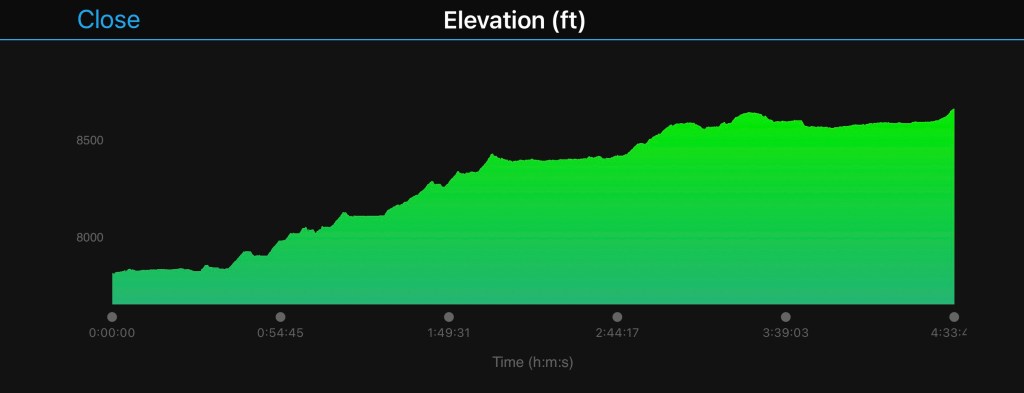
Monday morning it’ll be time to get up and get on the road to the Whitney Portal. That’s right, I scored a day permit for Mt Whitney! I have a reserved campsite at the Whitney Portal Campground, and hope to get there and get all set up by 4pm. After that I’m going to try to sleep for a few hours and get started with the hike about midnight. I’d like to do the hike in about 12 hours, putting me back at the campsite around noon. The rest of the day will be about refueling and resting up as much as possible, while still getting a good night’s sleep.
Wednesday morning will be another morning to get up and get going because we’re headed back to Yosemite. It’s time to tick Half Dome off the list! I’ll hit the road to the Lower Pines campground as early as possible, once I get to the valley I’ll get set-up, get my permit and take in the majesty of Yosemite Valley. I hope that being there in September will take the crowds down a little compared to the height of the summer, we’ll see…
Thursday morning I’ll probably try to start hiking about 3-4am to ensure I beat the crowds and any weather. After what I think will be an amazing hike, it’ll be back to the campsite to chill the rest of the day and then head back to Phoenix Friday morning.
Permit/reservation-wise, the Grand Canyon campsite is taken care of and I don’t need a permit for a day hike. I have a Day Whitney permit and reserved campsite at Whitney Portal. The only big hurdle left is the Yosemite stuff. I find out Monday the 11th if I get a Half Dome Permit, and on the 15th I can try and make a Lower Pines Campground reservation. If I don’t get a half dome permit but am able to get a campsite I’ll probably still go and try and get a daily permit lottery slot.
I’m going to have to be pretty fit and get a little lucky with the weather, but I think I can pull this off. It’ll be fun to try, one way or another!


